


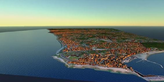
The entire municipal territory of Anzio has been reproduced within a Realistic Dynamic Three-dimensional Digital Model.
The proven method aims to achieve the analysis of traditional urbanism on a Three Dimensional Digitale model, through the use of Revit software and Infraworks, so we can see an immediate feedback of the actual situation and future of the area studied, a more immediate consultation with all levels, from the Public Administration to the Population , and a result that is technically and graphical accurate.